Sunday, December 27, 2015

Paddle-Packing the Cedar River, Mitchell County, IA

Paddle-Packing the Cedar River
Mitchell County, Iowa
July 5th, 2015

I had been looking forward to this trip for some time. We would be combining two of my greatest outdoor passions, hiking and time on the water – while also providing a rare experience for a full day adventure in the Iowa outdoors that required little to no backtracking. My co-adventurer Steve and I would paddle about 6 miles down the Cedar River from Mitchell, Iowa to just south of Osage, Iowa; then hike back along a county nature trail for 9 miles.

We picked up our aluminum canoe from a friend along the way, half pleaded him to come with, and then hit the road. What should have been a quick 30 minute ride was delayed though, as, while roaring down the highway at 55 miles per hour discussing the price of Iowa farm land, the bow of the boat, visible our the windshield, slowly lurched right, then violently swung off and hit the gravel shoulder of the road with a sickening crunch. Then the middle, still attached to the bed of the truck, caught, and caused the canoe to be dragged the boat twenty feet along until Steve could safely stop the truck. But what looked like a fatal blow to our trip just ended up giving us a more charismatic canoe. The bow was dented, badly, but otherwise she was structurally sound. The bow loop, which had been connected to the strap that broke and started the whole mishap was also ripped off, but we recovered it and Steve thinks he can repair it all.

The rest of the drive was uneventful, and we pulled into Mitchell's Interstate Park around 9:45 to find it full of campers still waking from the 4th of July festivities the night before. Interstate Park is named for the large dam, built by Interstate Power (now Alliant Energy), which is still functioning and providing power to the area. The dam, 15 or 20 feet tall, creates a long, gentle portion of the river above, and flood control below. It is one of only a handful of operational hydro-electric dams in Iowa today.


We put in on a gravel beach below the dam, kicked off and passed under the highway bridge we had just crossed over, and very quickly it was very quiet. Quieter, in fact, than we expected as it was a holiday weekend, and also because we had gotten quite a bit of rain in the last week and the Cedar flood easily, even below the dam. But it was not flooded today and with a strong headwind we actually had to paddle most of the day.

There is a road to one side of the river here, and the trail we will return by on the other, but for a long time all we see is a great blue heron and some swallows. We were down stream nearly two miles before we were able to do anything more interesting than watch a car go past, but it was still nice to sit in the warming morning sun and chat.

About two miles down from the dam, there is a small island separated from land normally by a slough, but with today's higher water, it was perfectly passable. We slipped over the rocks and debris that normally pile up at the head when the water is lower, and entered a pleasant green tunnel. But it was not just a pleasant green tunnel, it also hosted one of the more exciting elements of our trip.
Steve saw it first. Just fifteen or so feet off the ground, a massive Golden Eagle sat watching us from a branch. This river is home to many Bald Eagles – the year prior we often counted 4 or 5 at a time and even now there was a nest we'd see if we had stayed in the main channel – but a Golden is a much more rare bird. We are able to get close, probably within thirty feet, and confirm there was not way it could be a juvenile bald eagle, but certainly a Golden. A firm reminder that there is still much to be protected in Iowa.

Downstream again we joined the main channel, and it was calm and tranquil again. This is a simple, relaxing river, at least at this time and place. We are passing along the heart of a county conservation area, where things are left more natural and we can see what kind of power the river can unleash. Up on the bank, sometimes ten or fifteen feet about the currently elevated water level are dozens of branches, logs and tree trunks, some twenty of thirty feet long and wide enough around that two grown men wouldn't be able to reach. And this river tossed them like Lincoln Logs.

One thing Steven and I wanted to try today was paddling upstream. We had read about various people doing so while adventuring more remote places and were eager to give it a try and see if we were capable explorers. We chose a mark, a power line running along the Highway 9 bridge, and just after passing under it began a gentle paddle, time it for 60 seconds, then spinning around, we began to paddle furiously. It was harder than we expected, especially considering the strong wind now at our backs, and we worked every muscle to move the boat. We did eventually get back to our marker at the bridge and much to my surprise, it took us only twice as long to go upstream as down. But that was maybe 100 yards, I don't care to know what it would feel like over days and days and miles and miles.

We relaxed after our push upstream and the river slowly started to become more meandering. As a river rolls along and picks up silt, it begins to flow a differently. Water can only keep a certain amount of particles in suspension at a given speed, so when it becomes overloaded, the water slows, the particles drop out and build sandbars and islands, forcing the water into smaller spaces, which means that for the same volume of water to go through it must go faster, so it can and as it does it carries more silt. This is how any larger river will eventually for a set of sand bars, islands and channels that constantly move, and we were experiencing a miniature version on this upper stretch of the Cedar.

The high water meant the islands and sandbars weren't so much a navigational issue, but a problem of choice. We picked our way between clumps of sand and vegetation and did go down a side channel that we were unsure would let us out at an appropriate place to approach the upcoming rapids, but that only made us feel like we were in a little more remote locale.

We did get back tot he main channel is plenty of time, and were able to beach our boat in a campground called Spring Park and survey the situation. The rapids, a mix of just shallow water and large rocks, as well as rip-rap meant to solidify the parks position at the bend, went all the way across the river. With the damage from our transportation event we weren't keen to press out luck on any rocks, but after considering a portage had no logical re-entry point, opted for a relatively calm area against the far bank.

We hopped back in the water and had to paddle hard across, as our launch point was only 30 or 40 feet upstream of the rapids, and as small as they were, we did not want to hit sideways. As we approached the far bank, we swung the bow left just in time to hit the first crest and...nothing. We tapped a few spots of gravelly bottom, but otherwise the short section was no different than any other, maybe a little faster. Lesson learned: we need to spend more time in rapids to understand them.
Below the rapids, the last mile of our paddle took us between high wooded hills mostly devoid of obvious humanity. We spotted our bridge and pulled off to the bank, and scouted ahead on foot to find a place to fully pull out that would be close enough to both the road and a place to lock and hide the boat. We decided on a thicket of trees that would keep the boat of out sight, and still just at the bottom of the embankment to the road that would make it an easy carry out.

We first unloaded our small amount of gear, and I hopped into the back of the boat to paddle closer to our storage spot and Steve walked down to catch the bow and lift it over the rocky bank under the bridge. I waited until after he had pulled his canoe out completely to inform Steve that I had never paddled a canoe alone. We used a bicycle cable lock to secure our ride to a tree, grabbed out bags, and hit the road.

* * *

Iowa is known, accurately, for straight, flat roads overlooking corn, beans and hog confinements. But there are exceptions, and Lime Kiln Road is one of them. From the river, we followed a long, slow curving slope, passing a few small hay fields and cottages, and one massive deep ravine. Woodland crept in close to the road, and with almost no traffic, we felt more like we were in northern Wisconsin than northern Iowa. Knowledge that multiple black bears had been spotted locally in the past few weeks heightened the feeling. All in all, this was a very pleasant part of the trip instead of the slog I was expecting. And I'm sure we gave the few drivers we encountered a good smile with our odd combination of hiking gear and wooden paddles.


Lime Kiln Road took us eventually to the Harry Cook Nature Trail, operated by the City of Osage Park Board. It is a gravel and dirt trail, similar in appearance to what you often see in a rails-to-trails conversion, though that is not in fact it's origin. As near as I can tell from researching the history of the area, this is the old stagecoach trail townspeople would take to the same park we were headed to, but more on that later. We start by walking in a narrow wooded corridor between homes and a cornfield, but after a half mile or so cross a road into a more isolated, wooded section.

The sun has gotten high by this point, and the move to solid shade was very welcome. The trail moves closer to the river again, rolling over a number of small ridges between gullies. We pass through a dry creek bed, the same creek bed where the water that cut the massive gully along the road flows. It's unclear if the creek is just not making it this far (we know it exists farther north) or if flooding has caused it to re-route and join the river at a different spot. The hills start to make us feel isolated, glad there aren't many nature lovers out today. We are reminded, though, of the true rugged and secluded nature of our situation when we pass two older women out for a Sunday stroll. So maybe there is some “take what you can get” mentality here. Oh well.

When we come into sight of the river, we stop for lunch at the top of a slope 50 or 60 feet over the water. We finally saw our first boaters here, an impressive family with two adults and two small children in a canoe and a teenager in an inner-tube tied behind. I ate simple sandwiches and dried fruit and jerky, Steve a series of trail meal type items he was testing for a trip to the Boundary Waters later this year. As the conversation turned to “what would you do in a Zombie apocalypse”, we decided we were ready to move along. We met a young woman on a bike who demonstrated great trail etiquette by announcing herself when she came up behind us and walking her bike past us. She would be the last trail user we would see that day. I have yet to decide if it's great to get the isolation or sad to see such resources go unused.

The Harry Cook Nature Trail is technically just the portion of trail that runs from Osage to Spring Park, where we had surveyed the “rapids” a short time before. We arrived here on foot now to see a few more people preparing to hit the river for some afternoon cruising or waiting to pick up those started upstream with trailers. There were also people camping and generally enjoying the park, but again not as many as I'd like to see.

Spring Park is a very old piece of public natural space, especially for this rural area. It's use as a camping and recreation area goes back to 1894, when early citizens of Osage purchased it as a semi-private camping club from a local farmer. Eventually, after growing the park to protect more land, it was deeded to the city, the caretaker now since 1938.

The park is named for an artesian well that has been the central feature since the beginning. It is still tested and available as potable water year round (a service we happily utilized while visiting); and was in the past even used as a liquid refrigerator by early park owners, who had semi-permanent containers with holes that allowed cold water the flow through. This kept perishables like milk around prior to ready supply of ice while people often camped here for a week or more at a time.

Now the park has some nice shelters, playground equipment, bathrooms and about a dozen campsites which we passed on our way through before hooking up to the Cedar River Greenbelt Trail, our route for the rest of the day. Greenbelt trails in Iowa are generally trails on land that has been purchased from private land owners after flood damage, ideally to protect them from further losses while allowing the public access to this less-valuable land.

The southern section of the trail (north of the park) is less used, and we find ourselves hopping over downed trees and walking single file instead of abreast as we did on the stagecoach portion of the trail. One backwater stream had a nice tall iron bridge like you would find in an urban park, but another albeit smaller creek had only stepping stones and a wooden plank. The trail stayed on bottomlands for about three quarters of a mile, giving us occasional river views, and then after a last pass by an obviously regularly flooded bend in the river it veered uphill.

The soil on the trail was hard and well worn, as unlike other places it was not overly washed out and gullied. This was a testament to both good trail building taking the hill at an appropriate pitch and angle, but also the fact this was a hill that had seen probably thousands of years of floods by the Cedar and still stood its ground. All that remained was harder, packed rock and soil.

At the top of the hill we were greeted by a cornfield, and the trail took the form of a lane through some private ground. To our left, opposite the corn, was a woody savanna pasture that included perhaps an old farm site or a family's person vacation spot, complete with a pavilion, tire swing, and of course, a no trespassing sign. It obviously looked over the river and I'm sure that sign has been ignored many times. Someday, I hope, the land can become part of the greenbelt, but I don't blame the owner for keeping it to themselves.

This lane leads to a blacktop road, which we had to follow for a quarter mile, and then to a somewhat major highway (though still just a two lane road) which we walked on in order to cross the river and get to where the trail restarted. This minor inconvenience highlights one of the major inconveniences facing the construction of long distance trails in Midwest: access to public land. Even in this very progressive, outdoor-minded community, the trail has to follow one of the busiest roads anywhere within an hour just to connect. There is plenty of undeveloped or privately protected land, but whereas in other parts of the country easements are often utilized, here we get nothing. Combine this with the fact that Iowa, Central Illinois, Eastern Kansas and Nebraska lack almost any large tracts of protected land and it's a wonder we can go backpacking at all!

Once our route does rejoin a trail, after we went under the bridge to avoid crossing traffic, we are officially in the Falk Wildlife Area owned by the Mitchell County Conservation Board. In Iowa, County Conservation Boards act as a sort of mini-Department of Natural Resources, and were founded originally when some counties felt land was not adequately being protected for public use. Unfortunately county budgets can only carry conservation so far. We pass a few buildings – conservation office, heritage museum – and enter the woods. Like much naturalized land in these parts, this is an old quarry, probably for gravel, and the pits are now small ponds. One here hosts a family of swans, and because the prairie potholes that used to dot the fields nearby have largely been drained (as they have been across the region), these ponds are a welcome addition for naturalists and migrating waterfowl alike.

The trail climbs a small ridge which in reality is an old flood levy and turns to follow the river. There are a wide variety of trees here, mostly old large ones that predate the quarry operation, and smaller ones that have grown in since. On the river side of the trail, where sunlight has better access, there are many wildflowers, though mostly past peak now.

When the trail splits, to a higher pasture path and a lower river path, we stick with the river. It is at first a shelf of dirt and ruble at the base of tall cliffs, just a few feet above the river, if that. Presumably the reason for the split trail is to allow access during annual floods, though it also allows for looping without so much repetition. There were still a few places that were difficult to access given the recent floods, but horse droppings and hoof prints indicated it wasn't that bad.
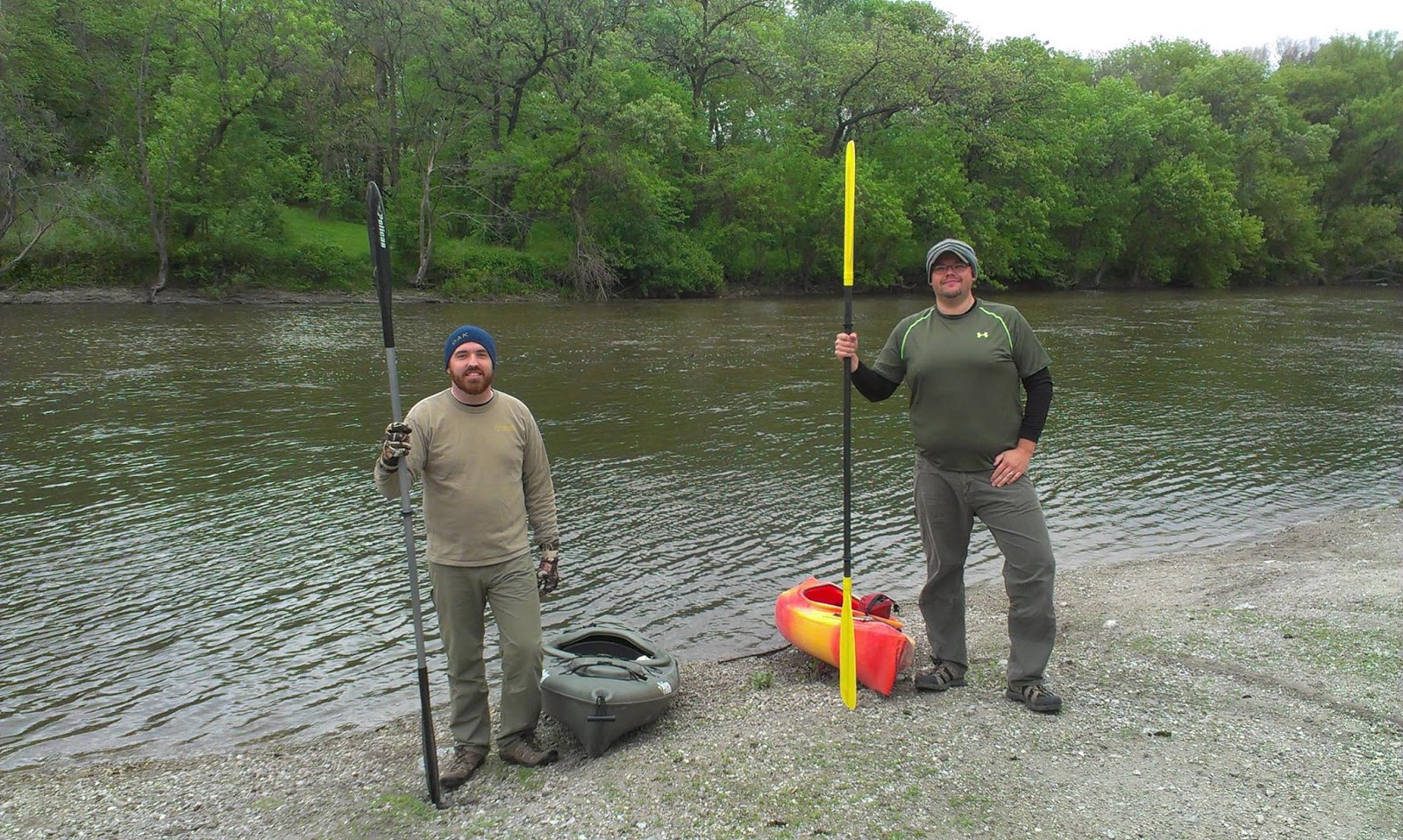
We did start to see people utilizing the river, especially more social groups of kayakers and tubers. It was mid-afternoon now, so apparently people just needed more time to get going. Many would holler and wave, probably confused as to why we were bothering to walk with paddles. Hopefully some caught on and were inspired.

We came to the spot near where we had seen the Golden Eagles, but on our northbound pass, it was the trail condition that was much more interesting.

A sign indicated we would be crossing private land for a few hundred yards, and the trail instantly fell in quality. It became narrower and full of tree roots. Where it went up a hill, it was a muddy gully; no leave-no-trace practices here. I could not imagine taking a child or a horse here (though obviously the latter had been done often). Again, private land owners unwilling to share the (unutilized) portion of their land for anything but the most marginal public use seriously hampers and entire communities exposure to the to outdoors. What could be a premiere destination is instead an afterthought.

Fortunately the next landowner is more open, and has allowed a wide gravel trail to be build just outside the fence of their cow pasture. We see a small herd in the distance on a hill, but they pay us next to no mid. The trail is very well built here, as much for bikes as hiking it seems. Rip-rap boulders of concrete and re-bar protect the bank where the trail touches the river, and a built up dam/bridge gets us across a woodland gully. It was almost too much, too far away from the natural setting I seek, but the river valley's overall beauty, and location in otherwise endless farm country, made it all worth while.

The path curved around the edge of the pasture between the fence and a surprisingly deep gully. No, not a gully, a ravine. We were in very short order 300 feet from the river and 200 feet above it, and the cleaved out portion of earth here between us and the water was almost vertical, and yet full of trees and underbrush. At the head of the very short ravine, we passed back onto public land at a small parking area, and the other side of the valley rose into a magnificent bluff top oak savanna. Trees often 4 or 5 feet around created a park like setting, though the grass was only loosely being mowed by a farm implement and there was much bull thistle. A burn would do the area well.

But it was inviting enough, and the trees were just the right distance to show off and trial his new hammock set up. I had never set up a camping hammock, and so the ease with which Steve set up a surprisingly complex hammock and cover was impressive. Sitting and laying down, I was amazed at how comfortable I was. I could easily imagine using this as is for many nights of the year, an a sleeping bag would make it capable of replacing any other means of outdoor lodging (provided of course there are trees). I quickly feel the urge to travel more wildlands, explore more remote corners of the continent, but first, to finish the day.


Even standing still for 30 minutes, we saw no hikers, no horseback riders. And we were less than ¼ mile from a parking lot on a beautiful Sunday afternoon. Perhaps, I think, the first step to a more naturalized Midwest is to get people to use what we have. And while there is something counter-intuitive about wanting a more crowded trail when seeking wilderness, there is still something to be said for supply and demand. And if people choose occasionally to paddle the Cedar River instead of the Brule, or hike the Loess Hills instead of the Foothills of Arizona, we might prove to the people at the purse strings that it is worth setting aside and protecting, or even restoring land here in the heartland. But we've got two more miles of hiking and these are thoughts for the wrap up of a story, not the middle.

Once the hammock is packed up (again, incredibly easy and fast), we keep moving north. The conversation dips back towards apocalyptic, with a question of how long could one stay in woods this small unnoticed, then paused on what large predators could survive here, then to another thought provoking incident.

Steve had been on this section of trail before, and had seen two men in camouflage, with guns, hunting. Unexceptionable for rural Iowa, hunting is the main driver of our Natural Resource program. But this was well out of any season, and they had rifles, illegal for hunting in Iowa. Poachers. Scary on its own, but troubling on a whole other level when we consider again that hunting is the main driver of Iowa's Department of Natural Resources.

Hunting is a huge driver of public land acquisition and protection across the whole country, along with fishing. The Federal Pittman-Roberts Act, which places a tariff on guns, fishing poles, and other related products has funded hundreds of thousands of acres of restored habitat that is also used by hikers, campers, and boaters. Hunters are often the leading conservationists in a community, and groups like Ducks Unlimited and Rocky Mountain Elk Foundation supplement Federal and State land purchases as well.

But when land is protected primarily, or even in extreme cases solely, for the use of hunting and fishing, and not the many other wide-ranging social, ecological and environmental benefits, a certain small sub-set of the hunting community can take the impression that other groups should be excluded. Of course, there are hikers who act out of line and interrupt hunters, the game gets away. When a hunter confronts a hiker, it involves a weapon in the hands of a the aggressive party. A totally different dynamic. And when the aggressive party is operating outside the bounds of the law anyway, it is best to avoid the situation all together.

I do not want to drive a wedge between hunters and hikers though. Quite the contrary, it makes the most sense for those groups to work together as closely as possible. The best times for hunting are often not the best for hiking (I don't want to spend all that much time with deer trying to make babies). And many times the best places for hiking don't offer the cover or clear shots needed for hunting. So if we can work together, demonstrate the demand for land is there, and then cooperate to acquire that land, we will all be better off.

After passing the poacher area, we were within about a mile and a half of the end, as several signs indicated, and with the trail being less than riveting here compared to much of the rest of the day, talk moved to plans for the future. And the quiet, isolated but well worn nature of this section lended itself to being more in thought than watching for other people or roots to trip on. We talked about what to do that night, where else to adventure in our back yard. This last mile, as I said, is flat, with nice views of the river. It's a good cool down for our legs and would be a nice warm up if coming from the opposite direction. The trail leads up to the road, and we must again walk on an unprotected shoulder across a bridge to get where we are going, the truck.

* * *

We cover the same section of river for the third time in a day, but again it feels totally unique. We are now focusing on houses and land for sale and moving at 40 mph instead of 3 or 4. We pull up to our canoe hiding bridge and gingerly descend to avoid parsnip as we go, eager not to get burned on this otherwise nearly fault free day. We haul the canoe up and load it awkwardly into the bed of the truck. We take back roads home for everyone's safety, and in doing so discovered there are more small creeks to explore than we ever knew. We just need to look, reach out, find partners for ourselves and for our missions, and regain access and protection for the land that can help us all.

Tuesday, July 28, 2015

Hiking the Lost Creek Trail, Fillmore County, MN

Lost Creek Trail
Fillmore County, MN
June 5th, 2015

When my wife dropped me off on the side of the road, I was stunned to see how much the trailhead was overgrown. I had helped with a native seed planting here years ago, and cut trees out after that, and both times it had been fairly barren. But now, despite the trail seemingly getting regular use, the healthy plant community had restricted the path connecting the road walk shoulder to the small bridge that started the more “natural” section of the trail to less than a deer trail. It bothered me that the trail maybe wasn't getting the attention I think it deserves, but it was good to know too that I would probably be alone.


The Lost Creek Trail in Chatfield, MN is a 7.5 mile long hiking trail modeled after the Appalachian Trail and the Superior Hiking Trail; which cuts across private and public land on the western edge of the Driftless Area. The first mile or so is a paved path in a city park and a broad shoulder walking lane on a county road leading out of town. I helped one of the trail's founders, who also happens to be my father-in-law, bushwhack the route early on, as well as build a few sections later, and we chose to start at this spot specifically because the county had the foresight to add a walking/biking lane when they rebuilt this road last.

The road trail goes as far as a property owned by the local historical society, meant to preserve the historic landscape of dense woodland. It is separated from the road by a small ditch/stream, that now has enough water flowing in it and plants surrounding it that it is actually quite pretty. There is a small old bridge someone donated that crosses the stream, and this is where I begin my hike.

The historical society site sits on a relatively gentle slope that has been selectively logged over the years to encourage good habitat and timber. The dominant feature I note immediately is soaring, arrow straight walnut trees. They create a wide open but shade filled domain that has allowed dozens of species of woodland wildflowers and the like to form a dense, waist high mat of green that I could almost hear respirating. Unfortunately, I could also still hear the occasional car zip past just beyond the confines of the woods. And so I was grateful as the trail got into a little steeper area where more trees had been left for erosion control and created a stronger barrier to the road. The path was also less interrupted by low-lying foliage, and soon turned up hill, into the defining landscape setting of Southeastern Minnesota. 

Here, a small stream has cut into a hillside, exposing the Decorah Shale Edge. Long, thin bands of limestone stacked on top of each other, remnants of an ancient sea bed, compressed over millions of years. The semi-permeable nature of the rock, called a karst topography, means water – even full blown streams – can disappear into the ground; and that springs pop up everywhere. All these springs and the streams they create combine with the easily erodible limestone to form a maze of canyons, valleys and ridges that can't be farmed and so make great woodland habitat to explore. This would make up a large part of the rest of my day.

The trail continued up the slope before turning sharply to the right and climbing near the top of the same hill that was being eaten away. Another quarter mile and the woods thinned. I came out into a grassy spot between the woods and a newly planted cornfield, and followed a line in the grass to a gravel road.

The road that I would be walking for the next half mile is a relatively light use gravel road, one that doesn't really go anywhere itself but connects two other roads. Running between farm fields with a few houses along it, this road does offer a stark contrast to most the rest of the hike. Along the road, in the ditches, are several sets of bird houses. 10 inch tall pieces of 5 inch diameter PVC pikes with wooden lids on metal poles, 15 feet apart with a hole cut into them.

These are designed for Eastern Bluebirds, a native species that has been negatively affected by the transition to bigger fields, which means fewer trees and fence posts for them to nest in. The nesting boxes provide perfect size cavities with the perfect size openings for Bluebirds. Of course, other birds, particularly wrens and swallows, are about this size as well, which is why the nests are placed in pairs. Those wrens and swallows are very territorial within their own species, but not towards bluebirds. So by placing the two nests close together, enthusiasts risk giving up one to ensure the availability of the other. And the metal pole? That's snake protection.

The road turns 90 degress and passes a field marked with signs pointing out the farmer is integrating hay into his rotation of crops and practicing terracing, both means of soil conservation. The road turns again but I continue straight, down a field driveway into a farm field. This is a corn field, you can see the stalks just coming up, but it also appears that this is the same conservation minded farmer. There is a wide grassy path around the edge for the trail, sandwiched between the tilled ground and a thick, lush green fence row. Milkweek, raspberries, ditchweed and a host of other plants are still in grow mode, just a few have started to flower or even bud out. These are the types of places that are critical habitat in farm country for species like bluebirds, but also games birds like pheasants and quail and even whitetail deer. They can use the habitat to shelter in bad weather or hide from predators and nest, and it provides for more food like seeds and insects over the year than the corn and soybean fields otherwise would.

The next section, though, shows not all fields leave this kind of space, as the planted ground goes right up to the forest edge, and would probably go farther if it weren't for the fact the forest was hiding a steep drop-off. Still, the property owner has allowed people to cross their private land, a rarierty. And they have their own conservation practices, particuarlary no-till planting, meaning much more organic matter stays in the soil and it won't run off as much. There are many ways we can have a little less impact on the land, and where we use them is as much a factor of where and how as who; it's important to recognize that and celebrate every step someone takes rather than berate anyone for lacking purity. I am able to keep a good pace here, too, and the position of the trail does provide an interesting contrast between the woodland and modern agriculture. I pass through a few places where the woods have taken a bite out of the corn and soybeans before pushing through a bramble of bushes and out onto another gravel road, this one a dead end with a few houses.

Where the road reached the trail marker to turn, there was an interesting sign. This section of trail is on a cartway. Public land, owned by the township that was meant to provide a right of way and nothing more. Not paved, no power lines, just a two track path that allows land owners a sort of back door to hard to reach places on their property. It is a legal tool used almost exclusively in Minnesota.
Along the cartway but facing the road is a house, with several paddocks in back, and then a fenced in pasture, all very bucolic. At the crest of a small hill, there is a small but broad canopied tree, and a turn in the trail past that. The trail enters a massive grassland there. Still being spring, it is bright green with only specks of purple and white dames rocket, or tiny bits of yellow from the just budding golden alexander. The next miles is a walk in this wonderland, and after only a few steps the rolling hills block out the last cornfield I will see until the end of my route. And in fact, the rolling hills of prairie grasses and flowers block out almost everything, and combined with the woods to the other side create a real illusion of wilderness. I pause for a while to really relish in the sight.

With the sun inching ever lower in the evening sky, I barely half done, so I moved on. I entered the woods on a bluff top ATV trail used by the landowners to harvest timber. The broad, clear trail allowed me to look up and take in my surroundings more than I had been doing in the grass while still moving, as the regular rain and sunshine had made the trail overgrown there and less visible.
The woods here were full of large, majestic trees. Oak, maple, and walnut dominate, in a few variations. But I have learned to identify stray apple, hawthorn and others as well. These are hardwoods and the northern edge of their habitat for the most part, and on north facing slopes coniferous woods like pines are more prevalent. This blend makes logging all the more attractive, as landowners have some flexibility to follow prices in choosing what to harvest and leave the woods more diverse. These landowners are definitely conservation minded as they take only the most choice trees, encourage the growth of others, and leave underbrush to secure the topsoil on the often sloping ground. The underbrush here includes myriad woodland wildflowers, shrubs, forbs and sedges, a carpet of green still transforming the woods out of its winter browns.

The logging trail rises and falls repeatedly, and my legs feel it. This is a fairly aggressive section of the trail and I'm taking it at a quick pace. I really hope to get out more, and while a six week old baby would hamper most, I hope to use trail time as bonding time. And a baby in a carrier makes for great training weight that looks less ridiculous than a full blown pack on a city street.

Heading down a hill I started to hear the trail's namesake, Lost Creek. Or so I thought. Finally emerging from a particularly dense bunch of trees I found a tiny creek, maybe two inches deep and four feet wide, the small canyon it was in echoed the babbling and making it sound much louder. Crystal clear water cascaded over fairy tale stepping stones, clearly someone was showing the trail some love.

And across the creek, yet another steep embankment that displayed the bedrock hidden just below the surface. City into that bank, where it was muddy instead of rocky, was a staircase, at the top of which a sign indicated it had been constructed by the Iowa/Minnesota Conservation Corps. Being an Iowa resident, it was a little sad to see we have so little outdoor space, so little to conserve, that we have to tacked on to a neighbor in order to have enough work to justify a team of teenagers and college students time. But it was a nice set of stairs and though I had spent a good five minutes resting at the creek, I didn't mind the help getting up the hill.

The trail here was back to a narrow single track, the type of trail that allows hikers to present they are so much further away than they really are. But here, one doesn't have to wholly pretend. Sheer cliffs and dense woods mean you are often several hours from disruption, or help. It is because of this that southeastern Minnesota harbors more wildlife that similar or even more northern parts of the state. In the last few years, bears, cougars, wolves and bobcats have all been sighted, some with enough frequency you might think there was a resident population. (Between when I took this hike, in fact, and when I am writing this, three bears have been spotted to the south in Iowa, along the southern rim of this Driftless area, and logic would point they would have moved through this very area last fall, and one seemed to be on the way back.)

But no sightings today, and shortly after a bit on this single track, I came to a fence with a special device that allows people to cross, but not let out the cattle that were being held within. After crossing the gate, the trail split into a high road and a low road, with westbound traffic (me) indicated to go low. The trail here was effectively a cow path, and in short order it finally led me to Lost Creek! The cattle, which were rotationally 'flash grazed' through here, had left a broad, grassy plain at the bottom of the valley and the creek had cut another two to four feet through the rich soil that accumulated during floods. Because the cattle had not apparently been here in a few weeks, and indeed were not here while I was hiking, the grass was long and tall, and the whisper it played so nicely with what could only be called a babbling brook.

Since this was a place cattle congregated, not passed through, there was no good trail. Instead, the blue arrows posted on trees that for most of the trail were just a gentle reassurance, were here the only sure way to know where you were going. These were joined by the occasional metal fence pole with a Lost Creek Trail sign and arrow attached. Normally, I would not be so fond of this intrusion into nature, but I recalled my first time crossing this pasture, the day we bushwhacked the predecessor to the trail. That day was not as fine a day as I was experiencing now, and our time was cut short in this field by a crash of thunder and a deluge from the sky. I would not want to be in that situation not knowing which way to go if I were a day hiker or with a small child.


I did eventually make my way out of the creek bed, and in walking up a small slope saw a sign that read “60 Foot Tall Cliff;” and sure enough, peering through the thick trees I realizes I wasn't able to see all that far because a great beige limestone mass was rising up out of the ground. I could see the top of the sheer cliff was covered in foliage and trees that looked identical to what I was walking in. The new awareness that this sort of topography existed in these woods, and in fact could so easily be hidden made me a little more cautious as I passed over another cattle grate into denser woods.
After crossing another small creek and climbing a valley wall the long way, there began to appear signs put up by the local conservation authority along the small logging road I'm now on describing sustainable forestry practices that were in use, as well as identifying some key tree species. Small 1985 and 2010 clear cut sections of woodland show amazing regrowth when there are plenty of seed producing adult trees around the edge. And the shot of sunlight through the canopy can help other plants there in the short run as well.

This is all the same idea as the rotationally grazed cattle, wildlife development and no-till farming. This is fragile land here, and not terribly receptive to “traditional” row cropping methods of farming much of the time. So some landowners have chosen to diversify their operations, and in doing so seem to have found caring for the land above and beyond in the short run leads to greater reward in the long run, as it so often does.

The trail turns off the small logging road for one last time and winder through a stand of large hardwoods before opening up to a massive prairie bordered by evergreen trees. Christmas trees in fact. White pines, spruces, and whole host of pointed top green giants that make of the older plantings of Thorn Apple Farm's Christmas Tree operation, though many of these are beyond being used for your normal family gatherings. They have now grown to full blown habitat and are headed towards timber status, though some are still used for churches and very large homes, which helps thin the stand as needed. The trail here is a broad, mowed path, and as it moves through big blue stem and gentian, it also passes one of the more impressive man made features on this landscape.
Decades ago, someone built an earthen dam in one of the many ravines, nearly 30 feet tall, it is erosion control and creates a small pond of water if you were to graze cattle here as a previous owner did. It also allowed for a road, probably for early pioneers, to be built back down to the creek bottom, which the trail now follows.

This section of Lost Creek was more native-esque than the cattle pasture, which also means the creek was much less often visible. Rather than able to see if for hundreds of yards, it was only though windows between walnut saplings and lush sedges that I could see the creek. The owner here was in the midst of a multi-year program eliminating the invasive Reed Canary Grass with a mix of tactics revolving around helping trees grow large enough they could shade it out. This allows a broader diversity of native plants to thrive, creates a more pleasant woodland, helps flood control, and again in the future will more for a better, more profitable timber stand.

I cross a small wooden bridge built just for hikers on this trail, which is anchored on only one end so it can swing out in a flood without being washed away, and then the creek disappears behind a wall of grasses. Crossing a culvert from Thorn Apple Spring, I can see a few dozen, well, wooden poles in the ground. They are young trees, willows and cotton woods, roughly two inches in diameter and 8-10 ft tall. They were harvested a few miles away, near where I started this hike in fact, and are inserted into small holes dug into the thick roots of the Reed Canary Grass. Because of their species, they will sprout both roots and branches, the roots below those of the mat-like grass roots, the branches above the reach of browsing deer. Freed from these two impediments that have held back reforesting, the trees grow into a canopy, eventually providing better deer habitat an shading out the destructive invasive grass.

The trails turns up a long hill out of the creek valley and into a forest of oak, hickory and cherry. It essentially doubles back and is now on top of a ridge 50 or 100 feet above the creek. I get my first reminder in a while that I am still in farm country, as corn becomes visible through the trees on my left. I am nearing the end, but this last mile has some excitement in store yet.

Just off the trail, near a sign marked “Blow Hole” is a unique little ecosystem called an Algific Talus Slope. Specific to this small part of the world, this quirk of geology occurs because of the wet, porous nature of the rock, the slope of the hill, and the wide variability in temperature through the year. In the winter, cold, damn air flows into the open fissure, freezing to sides and chilling the wet rock around it. Come summer, the cool air inside the mini-cave draws more air in, but cools it and the cool air flows through the cracks underground to other openings, creating cool spots that have harbored plants and animals that long ago migrated north or went extinct. This was thought to be the case with the Iowa Pleistocene Snail, which was rediscovered in 1955. These remnants exist throughout the Driftless area of Minnesota, Iowa, Wisconsin and Illinois.


Shortly after my visit to the blow hole, the trail leaves the logging road it has been on and enters a thick, rolling section of woods as a narrow but well trodden track. This is my favorite part of the trail. Steep switchbacks and obvious yet hidden presence of wildlife, tracks and calls and the like, makes it feel so much more remote.

After a long, steep descent, the Lost Creek Trail crosses one last small stream, a spring that has carved out an impossible valley for how small it is. Stepping stone rocks have been put in place, and standing on them I look back upstream into a fairytale glen of greenery. This is in a way the boundary of the deep seclusion of the trail. Crossing over I climb up the steep opposing side of the valley, actually slipping a little along the way, and finally emerge into an open prairie. In the distance I can see a few silos, and I hear a car go past.

There is still though interesting and impressive scenery. The landowners have direct seeded thousands of walnuts, acorns and other seeds in the past decade, and this is now a chest high forest where was once a cornfield. Opposite that, pine and other coniferous trees, particularly the impressively deciduous coniferous tamarack trees (which have pine needles which brown and die off in the winter), have created a pleasant savannah like setting. I pass by this and a hay field, trying to absorb the last bits of quiet as the sun creeps ever closer to the tree lined horizon.

I round a last outcropping of trees, again they hide a steep valley that feeds a spring into Lost Creek, and pressing up against a corn field the parking area and road come into view. I would take a short road walk and then cut back to the family house I was staying at, but most people will get in a car or turn around here. Someday, maybe the trail will be extended though, there is a bit more interesting terrain and landmarks to the west, but now now.


I have spent many hours on the trail. Scouting out a route when it was just an idea, building, maintaining and just enjoying parts of it. But this was only my second “through hike”, and my first alone. It was a wonderful reminder not just of the physical beauty that exists in Middle America, but the community beauty. This trail is almost all on private land, organized and maintained by private individuals, and paid for with donations and a few grants. We really lack access to nature in the Midwest, but the Lost Creek Trail does a little to fix that.

Wednesday, June 3, 2015

Kayaking the Winnebago River - Cerro Gordo County, IA - May 18th, 2015

It was a cold day, for May, and people thought we were crazy. 10 miles on a rarely paddled river after a full day of work when it was only in the 40's and threatening rain? What fun could that be?

But the threatening rain hinted at our weather for the last week and the reason we were so excited to go. It had rained, a lot, and the river was up a good foot or two. Not enough to be dangerous, but enough to help us over some shallows and move us along quickly. Neither of us had paddled this river before, but a short drive along the roads that paralleled the much of the river over lunch had revealed we should be fine.


Steve's wife dropped us off in the city park we were launching from, and I'm sure we got some odd looks as we loaded our borrowed kayaks into the water. A few moments of balancing and adjusting and we were off. The river was broad and gentle. We marked the time at a bridge Steve had used to calculate distances and slipped out of the park into a more wooded area. I had spent time on both banks of the river here, but viewing them from the water was just a little different, and they seemed new and foreign, exciting.

As we rounded a bend to head due east near Mason City's Murphy Park, a piece of floodplain forest where I was helping the Jaycees build a short trail, we caught sight of our first rapids. Normally a low head dam with a 12 inch drop, today it was a tossing, churning monster. You see, Steve and I have no whitewater experience whatsoever. This would be interesting. We tacked left the safely avoid a rock ledge I knew was hiding somewhere and went -WHAM- right into a wall of waves rising a foot out of the water. Chilly river water ran right over the front of my 8ft boat and right into my lap. I was half panicked and half frustrated. It would be half a mile before I could check how my dry bag and empty the water from around my butt.

We passed under a bridge and back into still waters as we cruised by the high school, hidden by trees. Across from that, where the road ran near the river, a man fishing smiled as we passed by. At least we weren't the only fools out enjoying the river today.

A quick stop at the non-existent Asbury Park canoe launch proved my dry bag a success, though I could not drain my kayak successfully. I soldiered on.

The river stayed wide and smooth for another mile, but then turned away from the road, into territory I had not been able to scout. And we hit rapids almost immediately. They built up size over three sets in the next half mile, swollen by rain. Fallen trees and the tips of submerged boulders gave us a limited trail to follow, and so we learned by trying various methods to stay dry and afloat.

Lean back to raise the bow above a wave then shift your balance forward as you crest it.
Back paddle briefly to hit the rapid at just the right angle.
Don't crowd your boats together.

Of course we made it, and in retrospect only crossed one rapid that would be of any consideration to most paddlers, a monster that dropped us nearly three feet. But my butt was still wet and water in the boat was throwing off my balance. The next access was a little easier and I was able to pull the boat all the way out and finally pull the drain plug. Dryer and noticeably lighter, we set off, through several miles of smooth water bordered by Iowa farmland hidden by a narrow band of trees.

Passage under an iron rail bridge marked entry to the town of Portland, one of those communities that is mostly a few houses built around a grain elevator. We passed an island that looked like it could be fun to explore, but because the Winnebago is not considered a “meandering river”, that island belonged to someone, and we would be trespassing.

Portland appears to be so named because of the Portland Cement made throughout this part of Iowa. There are several small quarries and the town sits on a rise of limestone, making for some wonderful scenery to paddle past. Dozens if not hundreds of swallows dart in and out of nests built on the cliffs that reach twenty and thirty feet out of the river, swooping down to grab bugs and mouthfuls of water all around us. Above, people have built porches and patios that project out over the water, many of them on impressive steel girders. We came to the river to experience what little nature we could find in North Iowa, but the chance to view the private sides of some impressive homes was fun as well.

The cliffs continued for a good mile. Here and there were wonderful little springs, generally accompanied by a bit of field garbage, indicating they were maybe not springs but the end of tile lines and drainage ditches. In a few places though, the rock rose up on both sides and it was much easier to to imagine that we were in fact out in real wilderness, watching for bears or wondering where to camp. In the cliffs, in fact, were sizable caves that looked like they would be perfect spots for bears or emergency shelter. Of everything we saw that day, these caves were the thing I would most like to return to.

After our majestic cliffs fell away, we came upon a stark reminder of the fact we were not in the wilderness, US Highway 18. US 18, or as it is known locally, the Avenue (of the Saints, because it connects St. Paul, MN and St. Louis, MO) is a massive four lane divided highway that may as well be an Interstate. But the interesting part was not the highway per say, but a spray painted line about five feet below the road deck marked “'08”.

Seven years ago, on June 8th, 2008, the river crested here at 18.75 feet, nearly 15 feet above the level it was as we zipped past. This was before I or Steve lived here, but the scars it lefts on Mason City are plainly visible as lush green areas along the river, where hopes have been wiped out and nature has begun to take her course. But this is not an almanac, and I will just leave with while the developed areas still show wounds from seven years ago, the few preserves of nature along the river seem as healthy as ever.

After that bridge the river again took us between two thin ribbons of trees with farm fields beyond, with a rapid here and there to provide some excitement. We saw our only real wildlife, but it was a good one: a green heron, not rare but not often seen up close as they prefer secluded riparian perches. With the wind at our backs we were moving at a good clip and were no longer worried about getting back too late. If anything, we were regretting not parking the car farther along down the river. With the river so calm, we were free to discuss real life, things like politics and finance. That to me is one of the great things about wilderness. On the river, you can talk about the real work and be on the same page as your companion. If you sit in your office or a coffee shop and talk wilderness, there is no guarantee the person you are speaking with sees the same rock, the same riffles in the water as you, and it is all a little more pretend that way.

Our final mile took us past Claybanks Forest, a stand of hardwoods on a hill too steep to farm, interspersed with big barren areas too rock hard to farm, and so it was donated to the county many decades ago. It is small, maybe 40 acres total, but the topography and riparian nature of it, as well as the fact that public land in Iowa is so few and far between, made it another place I intend to visit on foot.

The river took a turn to the north and suddenly we were faced with a prospect we had not dealt with at all in the last nine miles: we had to paddle to move forward. We fought to move, the cold wind hitting us doubly with a chilly mist and forcing our kayaks to not track straight. It lasted all of about 10 minutes, but it was just a little more excitement to our day, well appreciated at the end.

And at the end we were. Once the river turned back east, we began looking for a pull out spot as a small concrete bridge came into view. On a gravel road that had no houses on it, the bridge had been a perfect place for Steve's wife to drop off the truck. With the water high, we were able to nose our boats right on to the grass at the base of the bridge and scramble up a rocky slope onto the road.

As we loaded the kayaks, Steve noted how despite his pants being so wet he had to change them, his socks were still dry, and on our drive home scoped out from the road a few places on the river we had been. Then it was back home to our families, hot pizza and cold beer.

Paddling the Winnebago, short and developed as it is, was an inspiring reminder that while we have no Wilderness, capital W, in Iowa, we all have little bits of wild in our backyards. If we utilize them a little more, we might be able to grow them.